Traffic Speed Monitoring
MVAS Data from latest fortnight's readings
Currently, though it is showing the speeds correctly to passing motorists, the MVAS is advisory only as data is not being recorded since the end of 2022. The Council VAS readings are uploaded quarterly. (Current reductions in speed breaches on Newcastle Road may be because of Bar Hill road closures in Madeley.) 5 new machines are being provided by HS2 so no decisions on remedying this are being taken until that has happened. For past data, having opened the Excel data by clicking on the link above you will be presented with a page headed by a box titled
Sequence Average and Maximum Speed
Below this is a graph and below that dates and times.
If you left click (depending on set-up) anywhere within the box it will highlight the box. You can then “hover” over any point on the graph which will then give further information i.e. day, hour and speed.
On the left side outside the box are headings two for more detailed information
· Chart, which you’re already in and immediately below that
· Table. This gives average information on an hourly basis
· Table again, under Raw Data, this gives every activation and often runs into the 100s of thousands as vehicles are “Tracked” and will activate the device more than once.
Unfortunately again the latest figures received, from the A51 at the School, Woore, showed numerous vehicles exceeding the 30 mph speed limit, some over 60 mph, but again hardly any above that.
Further analysis of the MVAS Data shows 3,518 prosecutable incidents (vehicles travelling at more than 35mph) at this location (which covers the School entrance) during the period.
This location (the school entrance) has had the MVAS located there for 180 days YTD in Jan, Feb, Mar, July, August, September, October and November showing a total of 50,644 prosecutable incidents.
To date no data has been provided as to any enforcement action or prosecutions during the period.
We have again published the latest VAS readings from Shropshire Council (first quarter), from the fixed positions on Newcastle Road and at Priory Gardens. These are now being supplied promptly at the end of each quarter.
Information on Operation Snap, whose signs you can see around the village, can be found here.
*************************************************************************************************************************************************
Apart from our Parish Council owned Mobile Vehicle Activated Sign (MVAS) there is a fixed one (VAS) located on the A51 at Priory Gardens (facing south towards The Chetwode), the information from which is located above under Pipegate. We are able to publish this only once SC forward updated information to us, which we do as soon as it's received, currently quarterly. There is also a VAS on the A525 Newcastle Road entrance to Woore. We are glad to note that these do seem now to be regularly sent to us at the end of a quarter, the latest for April - June 2022.
We are pleased to advise that we have received figures showing there were 55 Notice of Intended Prosecutions (NIPs) covering a 12 month period. This has led to the area being “of low concern” as it shows only 2 per hour of attendance.
Unfortunately, in spite of a request by the PCC, Road Safety Data continues to be a low priority for Shropshire CC, with the long wait for new figures for the VAS’s installed by them. Nor have they to our knowledge done any analysis of the figures on these VAS’s.
*************************************************************************************************************************************************
As the mid-March 2017 MVAS readings showed two vehicles exceeding 90mph that month we did some further analysis, and the story was picked up by the local press (below):
Of 60,424 vehicles .75% were exceeding 50mph which equates to 453
.04% were exceeding 60mph which equates to 24
.01% were exceeding 70mph which equates to 6 of which 2 (as above) were over 90mph
Worryingly many of these were between the hours of 07:00 and 23:00
This story received further coverage in the local press:
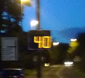
One of the MVAS signs in operation
